Consequent to LS telcom’s development of a unique RF measurement vehicle, broadcast and telecommunications operators and regulators will be in a position to determine, in an easy quick and cost-effective manner, the true onsite radiation characteristics of their RF transmission installations. They will also have easy access to high resolution video and photographic recordings of the ground facilities and the mast. These records are extremely useful to determine the technical quality of installations/maintenance on the mast and to establish an inventory of equipment and mounting space on the mast.
THE SERVICE
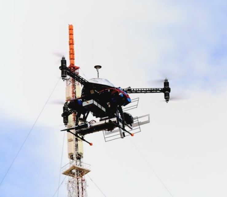
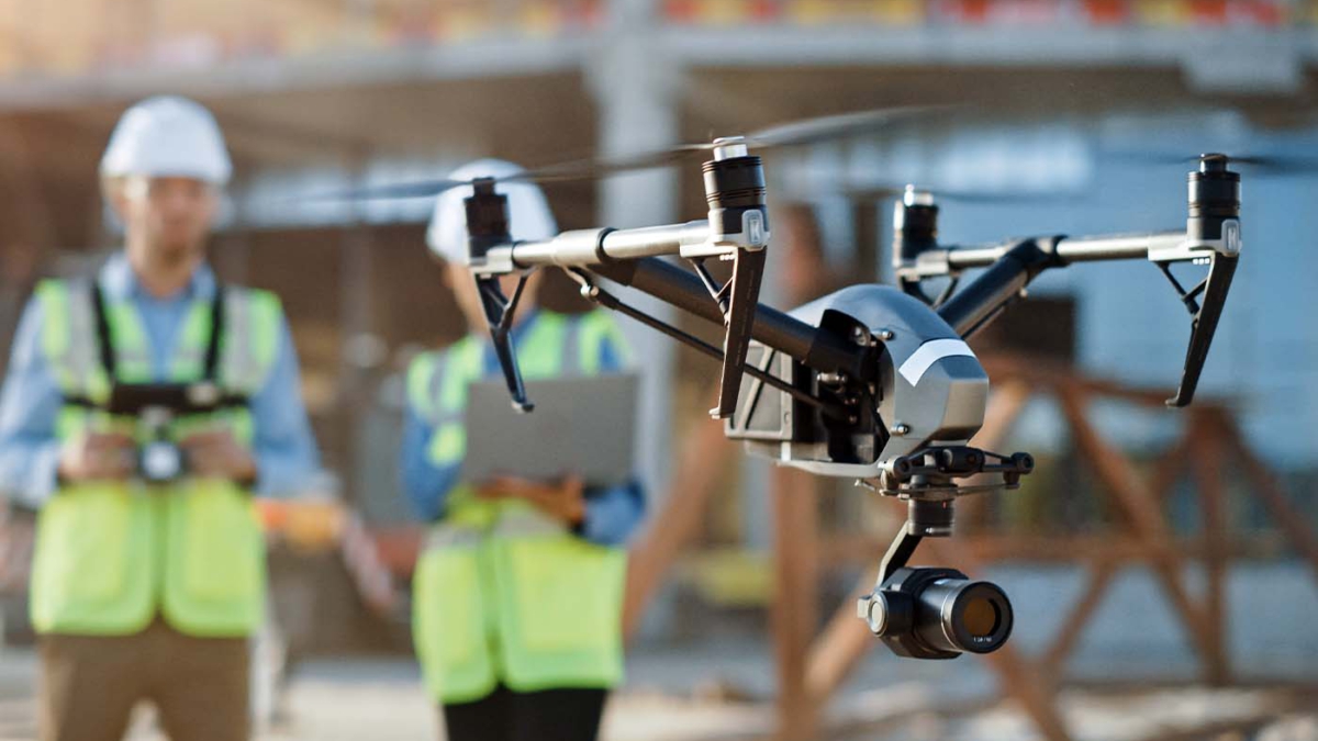
LS telcom offers this as a turnkey service solution. It is made possible by means of remotely piloted aircraft (RPA), which include either a measurement and sensor system or a camera on-board. The RPA circles the antenna to measure the radiated energy in the azimuth and elevation planes at specific distances from the radiating antennas. While the measurement flights are recorded on board in high definition wide angle video format, a separate RPA specifically equipped with appropriate HD photographic equipment is also available on site for such recordings.
HOW IT WORKS
The complete solution consists of the latest RPA technology which is adapted to carry the measurement sensor, high resolution position and orientation sensors, an autopilot, a high powered processor and storage unit and a telemetry system. The measurement and navigational data is stored on board and also streamed to the ground control station in real time. The RPA flies either totally autonomous or semi-remote controlled and in accordance with a pre-programmed flight path. Several safety features are built into the system amongst which is a ‘return to take-off point’ in the unlikely event of remote control failure.
The distance at which the RPA circles the antenna varies from 50m to 600m depending on the site, the type of measurement, the type of antenna installation and bands to be measured. Flight path distances are typically 3Km long in the broadcasting environment.
This RPA-measurement-service is obviously much more cost-effective than carrying out measurements in an actual manned helicopter. It is also obviously much safer to fly, especially in confined spaces, as it has an accurate flight path on all axes. Any deviations from the flight path are immediately detected and compensated for in the end result.
In flight differential GPS positional referencing is done for all measurement.
In addition to broadcast facility measurements, this solution is also ideally suited to do mobile communication site measurements. Obviously such measurements cannot be carried out by a conventional helicopter.
FINAL TESTS COMPLETED
While this approach may seem fairly logical and easy to realise for the layman, the development of this solution spans a number of years where a huge number of iterations were covered to finally produce the accurate results currently possible. These include parameters for calibration, stabilisation, navigation, positioning, data streaming and the quality and repeatability of the actual measurements. All of this needs to function flawlessly in extreme RF radiating areas and under challenging environmental conditions such as on high mountain tops.
This is why, after the proof of concept last year following a five-year research and development period, the system has undergone another series of extensive tests and now guarantees reliable results as well as high stability and safety.
THE DELIVERABLES
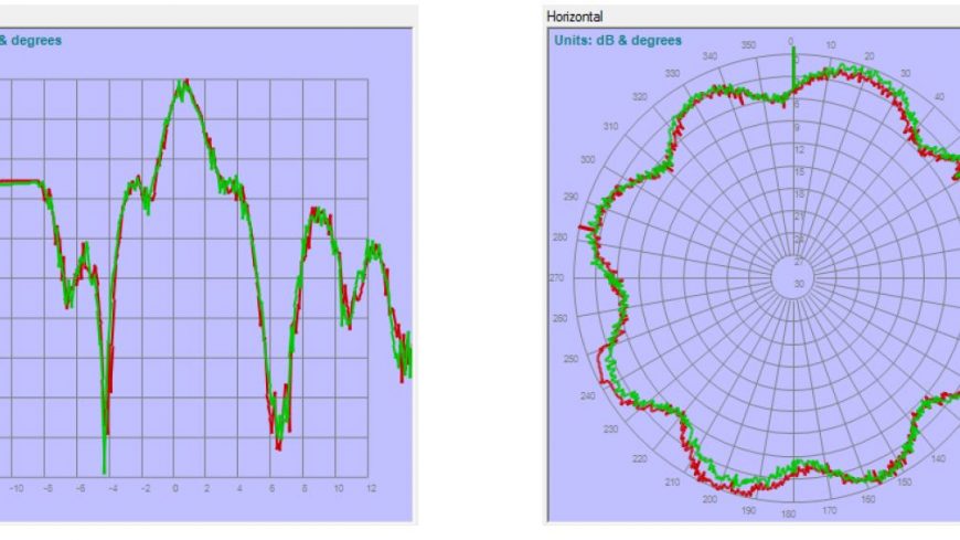
The deliverables of the in-flight measurement service include horizontal (HRP) and vertical radiation patterns (VRP) and effective radiated power (ERP) per service. The performance of the transmission system can thus be accurately
quantified. The results may be used, in turn, to determine coverage deviations from the design intention. The measurements for all programmes for a single transmission technology can be carried out in one flight. To confirm the absolute reliability of the results, all flights are duplicated and the results overlaid for the benefit of the customer.
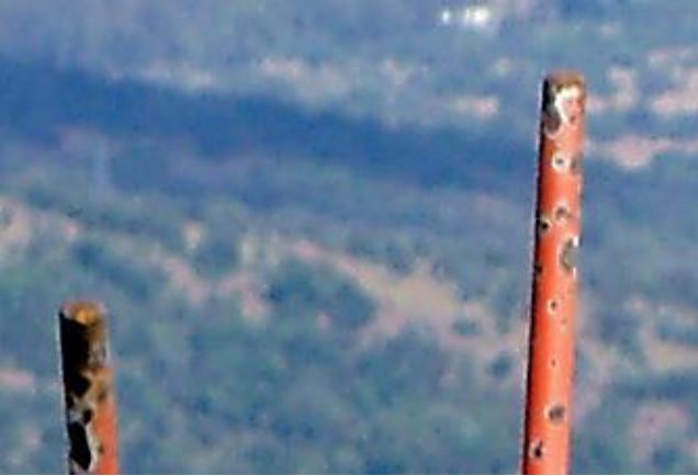
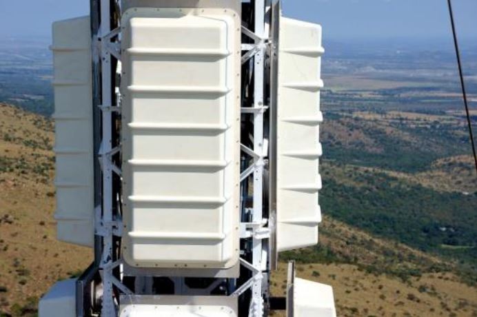
The deployment of the photographic RPA brings great additional value by providing details for mast inventory, such as antenna type, height, status of paint work and rust on the mast. It enables desktop assessment of the installation and infrastructure, before and/or after the work of installation and maintenance teams. This is especially convenient and advantageous where climbing up the mast is cost-intensive and normally requires down-time of the transmitter for inspection.
THE ADVANTAGES IN BRIEF
The advantages for network operators of this revolutionary service are two-fold: not only can they optimise network coverage and guarantee expected service level to their customers in a cost-effective way; they will also be able to reduce their infrastructure maintenance cost.
This equipment inventory service also allows operators to easily and quickly quantify any possibly available space for rental to third parties.
Interest in this service offering was received worldwide.